At the weekend, I came across a cool new tool – Drone Deploy – which can be used to create 3D images (and more) by stitching together hundreds of geo-tagged images taken with a drone. Whilst it’s early days in my explorations of this fantastic app, I’ve already figured out a few things that might help other drone pilots interested in making 3D models.
Here’s what you need to know:
Drone Deploy is an app, with versions available for both Android and iOS. After downloading and registering the app, get yourself on a wifi connection and use the handy search feature to find the location where you want to map. Within the app you can set altitude, speed of flight (which impacts the number of images captured), as well as the number of courses back and forth within the area that you wish to fly. Perhaps obviously, the more images you capture, the better. Also, there is a setting for the drone to use the point of interest function of the drone at the end of the way-point guided flight – I found that doing this reduces the “melting” that you sometimes get on buildings.
When you plug your handset into your flight controller (note: I have a DJI Mavic), you might find that the app can’t connect to your drone. This happened to me the first time. The fix is that you go into your phone settings, select the DJI Go 4 app, then delete the USB defaults. Restart your drone and controller, then plug the handset back in and you should be asked if you authorise Drone Deploy.
When you are ready to fly, you select the flight you made earlier and press the flight button. The app will run a few checks, then you’re off. The first few times were a bit disconcerting – I had no idea what would happen – but the app flawlessly controlled every aspect of the flight. Once you’ve flown all the way points, the drone will go into (see above) POI mode until you select home, which brings it back to the point of takeoff.
I found it useful to also fly the drone manually, taking photographs at various distances and from various angles, to again fill in the gaps between images that lead to a sort of “melting” on the edges of buildings. You then upload all these images to the Drone Deploy website and wait a few hours for them to be processed in the cloud.
The results are very cool – it creates an almost video game like 3D model of the building, scenery or whatever you’ve photographed. There are other views as well: one that shows “plant health” and another that shows the height of elements of the landscape. In another test, earlier today, I photographed a flat area of Verulamium Park, in St. Albans, where once stood a Roman city. It was possible, toggling between the landscape and plant health views, to locate the underground foundations of some of those ruins.
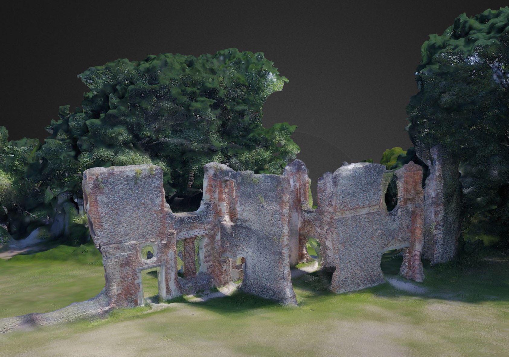
In the embed below, you can explore the ruins of Sopwell Priory (known locally as Sopwell Nunnery) in St. Albans, which was built in around 1140 AD. Double click to move towards a specific object. Use your trackpad’s up or down motions (two fingers on a mac) to zoom in and out.